
September Arrives Hot, Humid and Stormy in Brandon |
Highs stay in the low 90s while afternoon thunderstorms become increasingly likely through the week, bringing the potential for heavy downpours, lightning and localized flooding. |
By Ralph
September may arrive Tuesday, but don't expect Brandon to suddenly feel like fall.
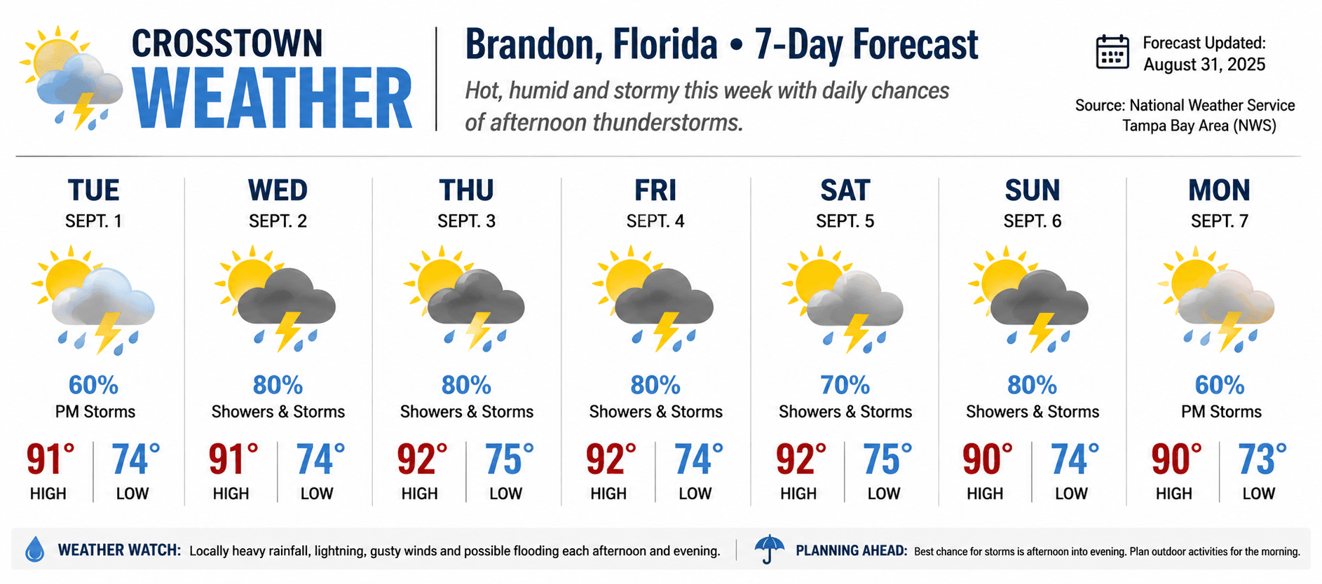
The National Weather Service expects warm, humid conditions and numerous to widespread showers and thunderstorms throughout the upcoming week, with daytime highs generally hovering around the lower 90s. Tuesday Starts the Month at 91°
Tuesday should begin with plenty of sunshine before thunderstorms become more likely later in the afternoon.
The forecast high is approximately 91°F, but humidity could push the heat index as high as 104°F.
Rain chances climb to about 60%, particularly during the afternoon and early evening. Wednesday Through Friday Look Wetter
By Wednesday, Brandon's rain chances increase considerably.
The current NWS forecast calls for an 80% chance of showers and thunderstorms Wednesday, Thursday and Friday, with highs around 91–92°F and overnight lows generally near 74–75°F.
The pattern should favor storms developing or becoming more numerous during the afternoon before moving westward toward the Gulf Coast into the evening. What We're Watching
The National Weather Service says the biggest concerns from this week's storms will be: 🌧️ Locally heavy rainfall — especially in poor-drainage areas. ⚡ Frequent lightning — remember that lightning can strike well away from the heaviest rain. 💨 Strong, gusty winds — possible with some thunderstorms. 🌊 Localized urban flooding — repeated heavy downpours could temporarily overwhelm drainage in susceptible areas.
Additional tropical moisture is also expected around midweek, helping maintain the wetter pattern.
|
0 Comments
Join the conversation
Be the first to comment
Share your thoughts above.